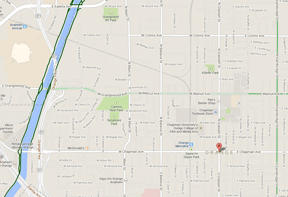
So I’ve been looking at a particular route on Google maps for some time. It starts at the Santa Ana River Trail (SART) and Orangewood (Walnut), goes past Chapman University and Orange High School and ends at the Santiago Creek Trail near Grijalva Park. Google keeps telling me that this is the safest route to get where I’m going.
I’ll admit I was skeptical, but I’m always looking for safe ways to get from the Santiago Creek Trail to SART so I guess I was skeptically hopeful? So yesterday evening, I took the route for my evening commute.
When I got off SART on Orangewood, I was immediately greeted with no bike trail or shoulder. The far right lane is a right turn only lane to get on the southbound 57. The second lane had the option of going straight or getting into a lane to get on the northbound 57. The cars that are turning are getting on the 57 and are not going slow. I was able to get into the far right hand lane and take the whole lane since there wasn’t enough room for a car and a bike, then I had to split the lanes between the cars that were going straight and the ones that were getting on the northbound 57.
I’ll admit I’ve gotten somewhat used to these kind of issues, but I do try to avoid them, and I would not consider them “bike friendly” in any way.
Still trying to maintain some optimism I thought to myself maybe the intro to the route is a little rough but the rest of the route will make up for it.
As I proceeded down Orangewood there were two lanes, but the right hand lane is not particularly large and the road winds a bit. While not horrible, I did have a constant flow of cars on my left elbow, and the bends made me nervous that a texting driving could be an issue.
Orangewood turns into Walnut at Main St. and enters a more residential neighborhood. I figured this must be the good part. Turns out it wasn’t good at all. There were cars parked along the street for the entire stretch. The remaining lane is not large enough for a car and a bike to share, and the steady oncoming traffic made it impossible for cars to drive around me. So I was forced to take the lane to the aggravation of the motorists around me.
Passing by Chapman University I had to evade a young driver pulling out of a parking lot while texting. Near Orange High School, I watched a young driver run a stop sign. While this could happen anywhere, there was in general a lot of chaos and experimental driving near the schools.
The route did get pretty decent past Tustin St, for that last quarter of a mile or so. I’m going to submit my recommendations to Google Maps, but alas, you can’t believe everything Google says.